Procesy5 GIS operations examples
- Procesy5 ProcessEditor configuration mainly to achieve some dedicated access to Business Data Object with Spatial Features
- WMS Map Support Server together with WMS raster files deploying capabilities
- Projecting network infrastructures via Qgis or Autocad3d or
another tool able to talk to System API with WFS-T
native specifications support
-
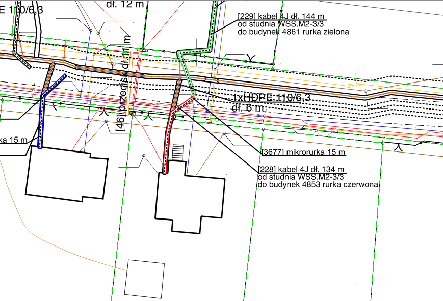
Figure: see projecting map and projected networks in cloud working
-
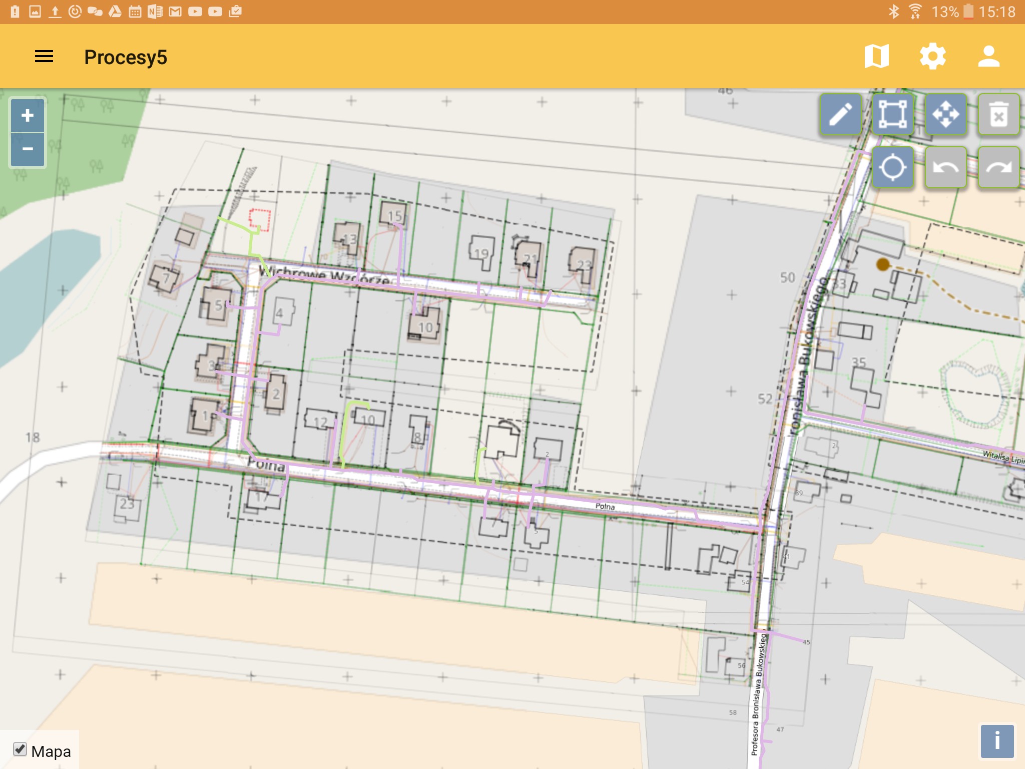
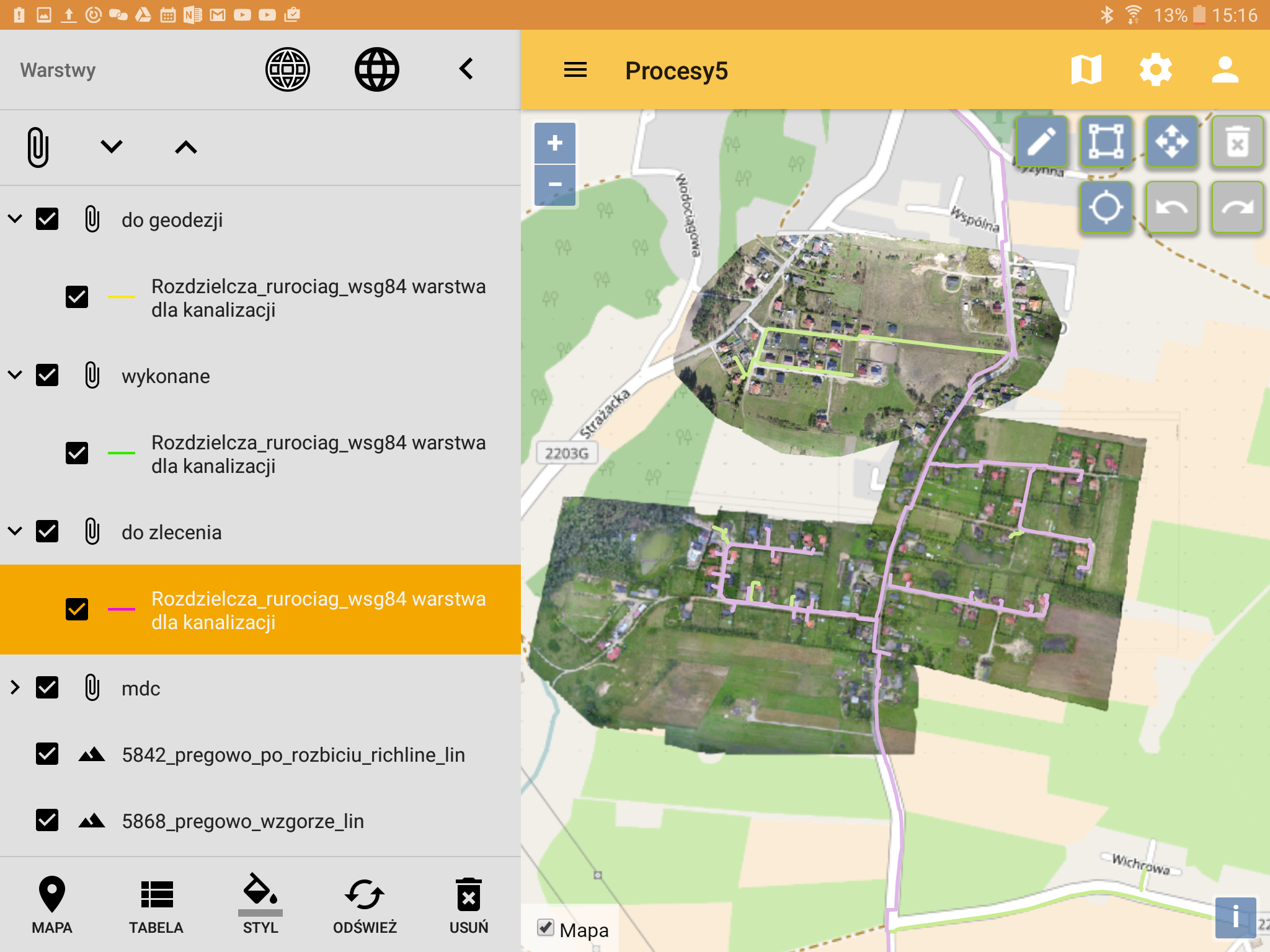
Figure: live projecting with Android online with projecting map integrated with Procesy5 WMS Service
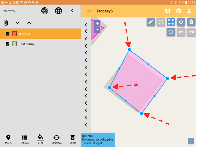
 Note: Consider using edit method described in Szybka aktualizacja współrzędnych typu wielobok (Polygon) dla istniejącego rekordu, wyzwalane od strony tabeli
Figure: fast editing feature method
- Project elements controlling
-
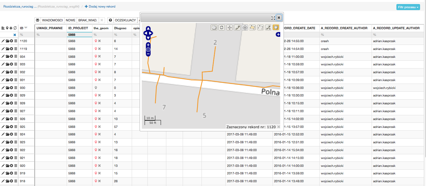
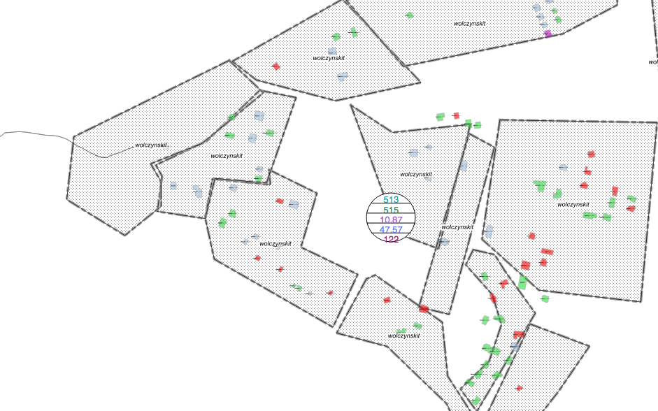
Figure: see elements in table view LIVE
-
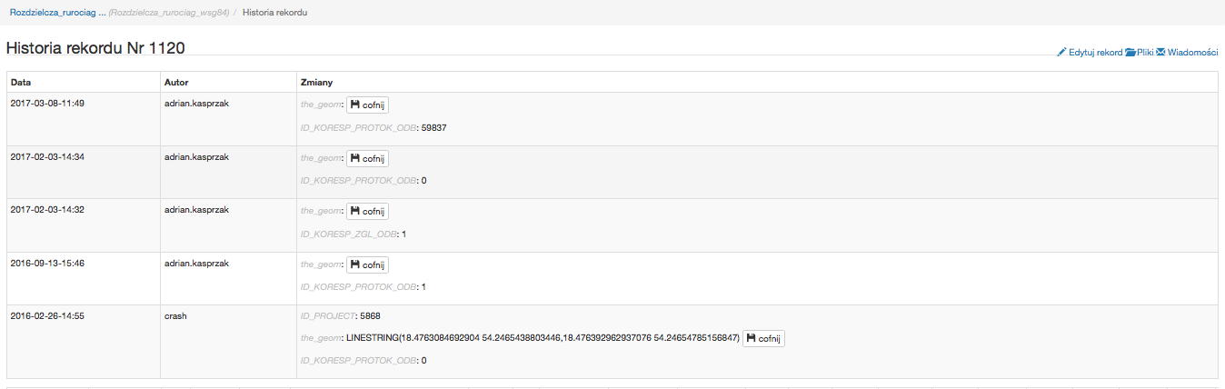
Figure: full element changes history protection and controll
-
-
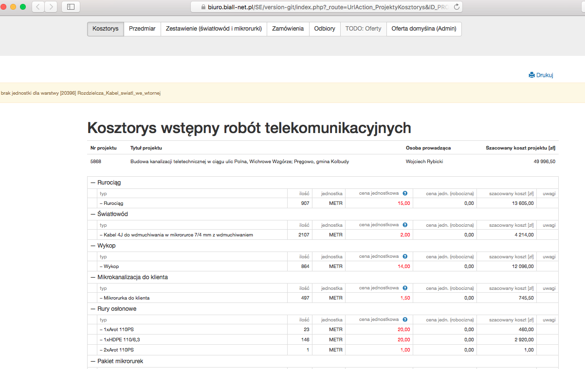
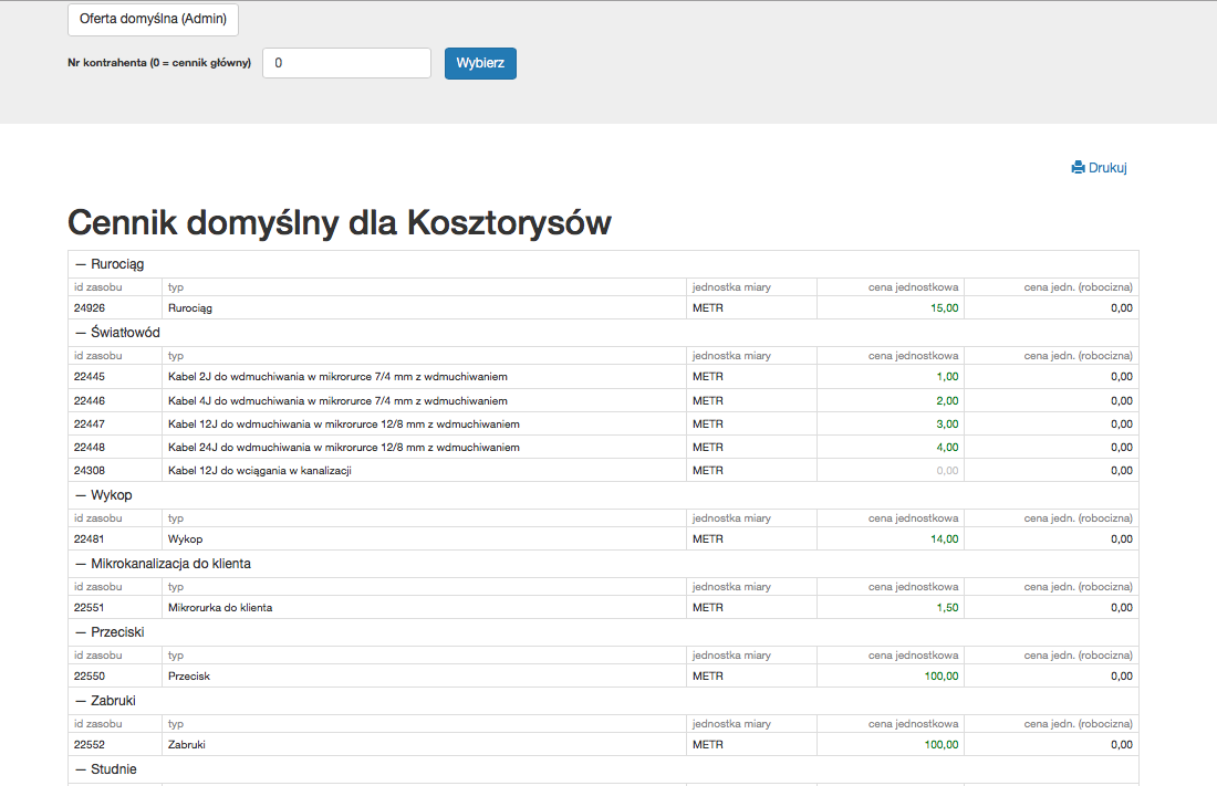
- Cost planning in our Procesy5 ordinary web interface
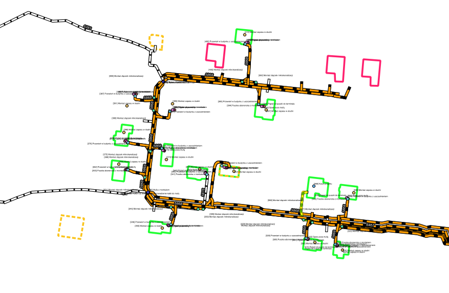
Figure: live measurment parts list

-
Figure: Live cost list
-
Figure: live offers portal for concurent offers managing
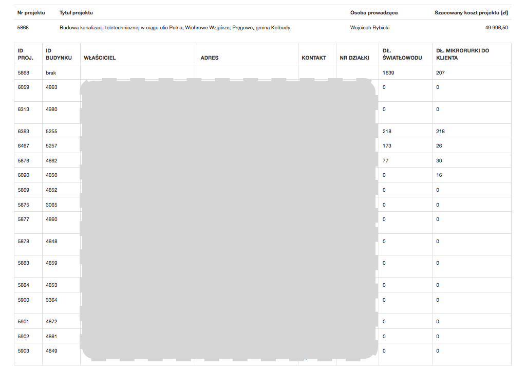
- Controlling investment process by using
-
Procesy5 ordinary web interface
-
Figure: live task list for fiber connections with contacts
-
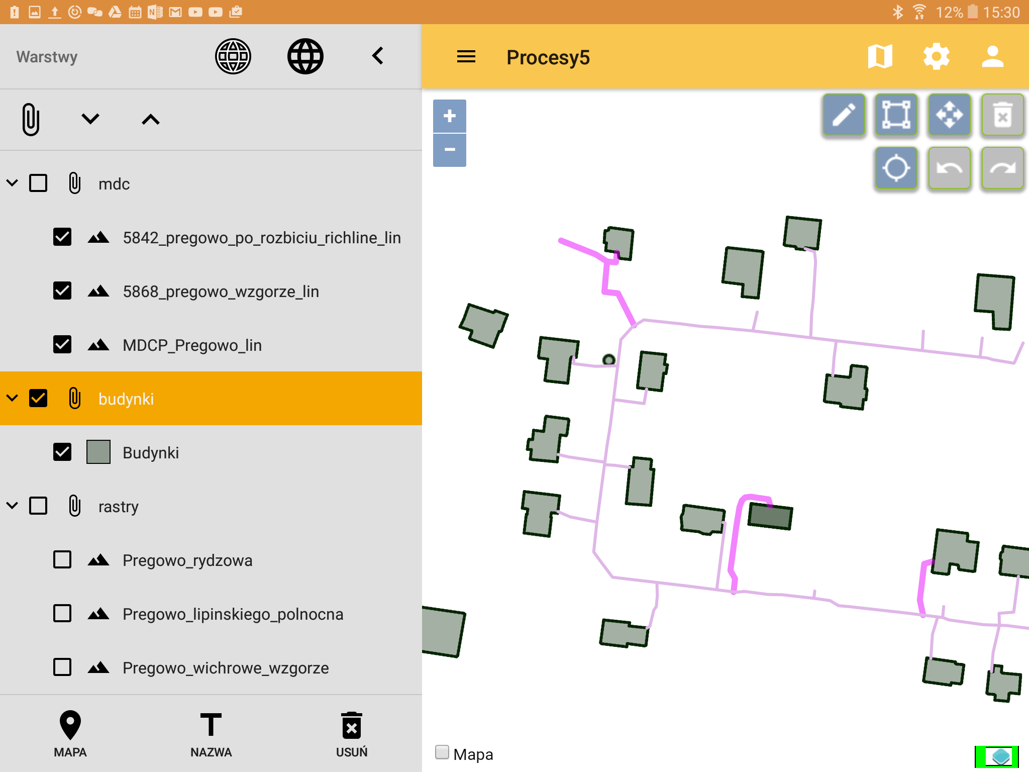
- Procesy5 native Android Application
-
Figure: invest area overwiev
-
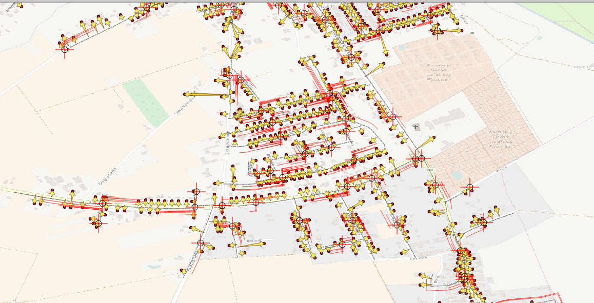
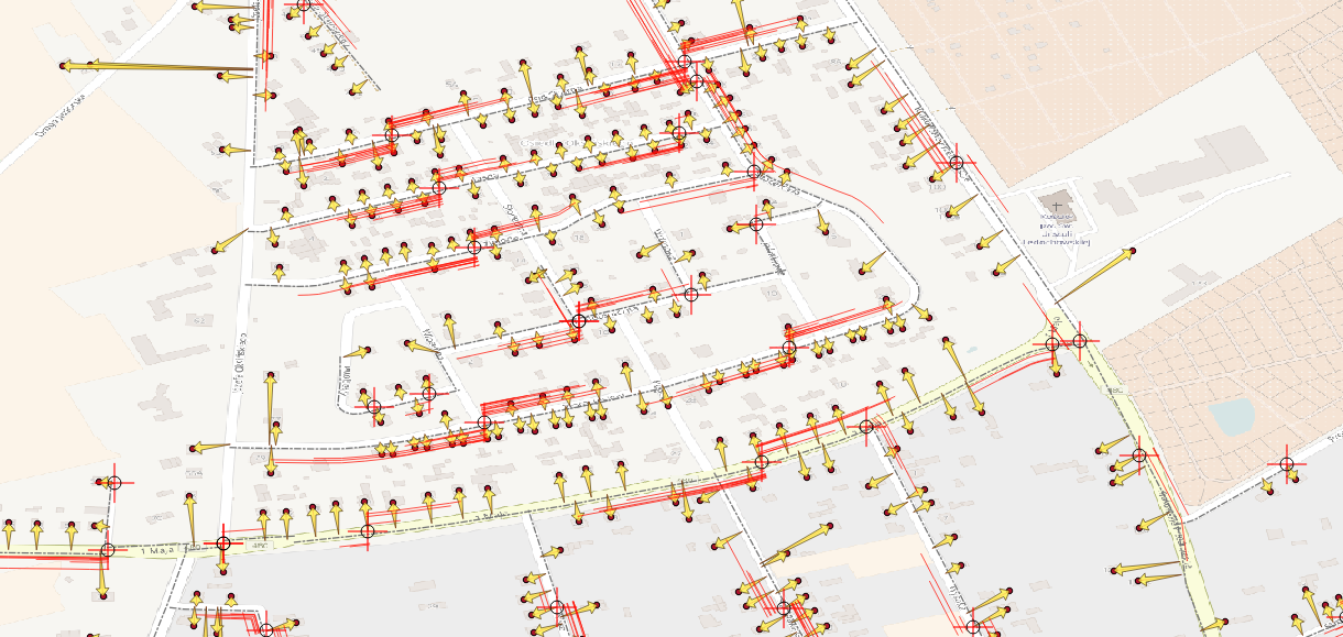
Figure: live invest area with also integrated drone map with georeferencing quality
-
-
Procesy5 ordinary web interface
- Sales and marketing management
- QGIS Interface example
-
Figure: sales areas example
-
Figure: invest sales example
-
- Many scenarios can be set just by configuring in Wykaz elementów funkcjonalnych Procesy5Android our Menu Warstwy (nagłówek) or in another Procesy5 interfaces GUI Development
- QGIS Interface example
-
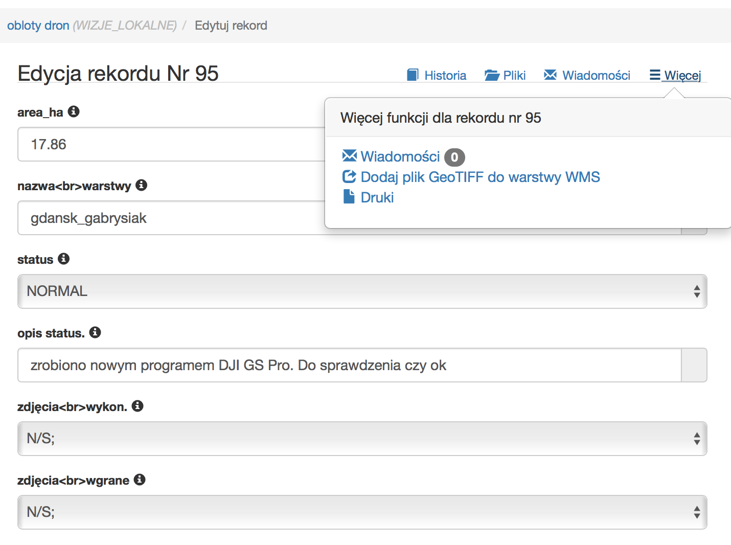
Figure: visible table for planning georeferening drone-mapping process in web-gui
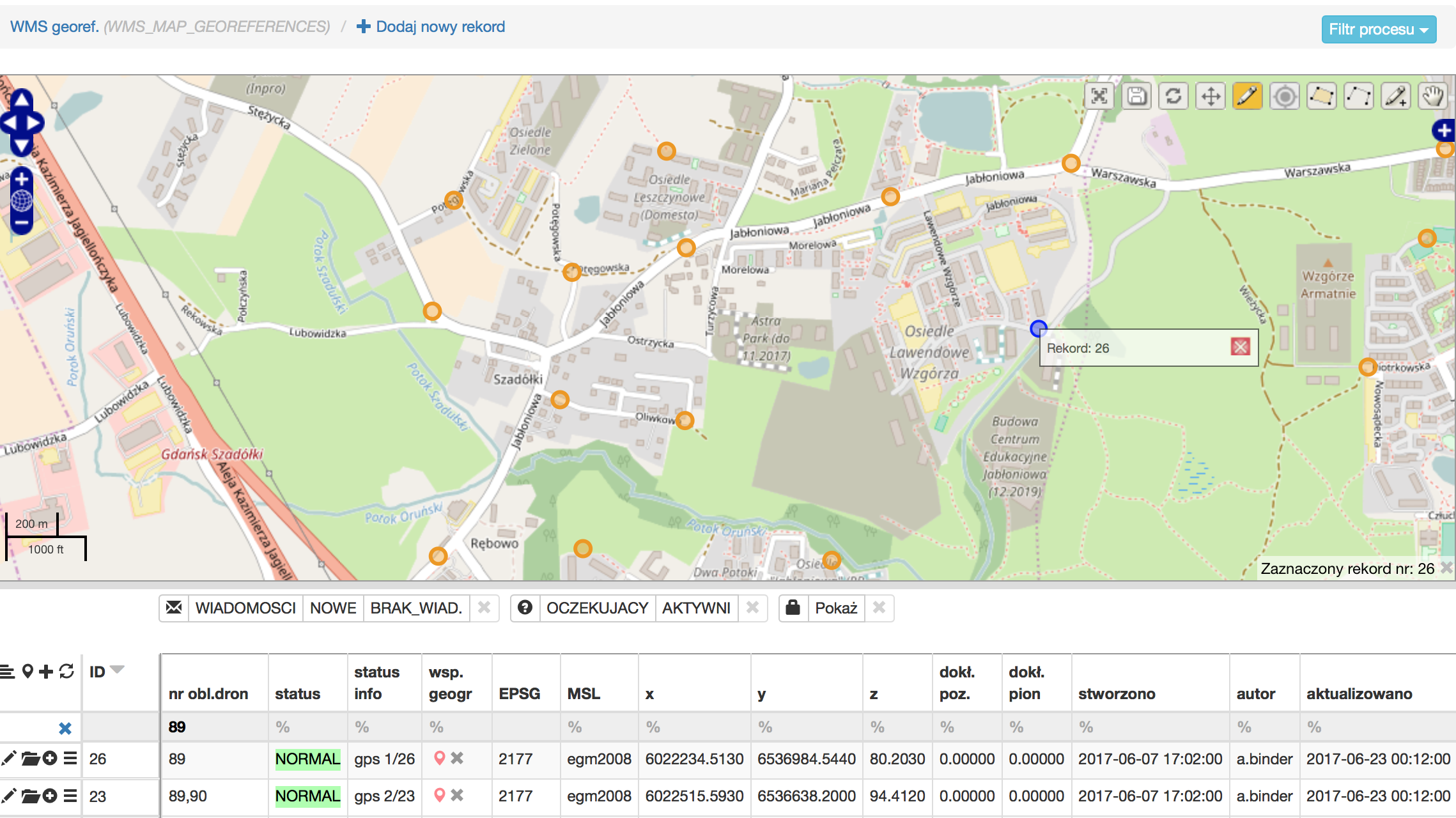
Figure: Loot at aviable context menu to allow generated map to be added to embedded WMS Server/Layer